Watershed Mapping in Dense Forests Using UAV-Based Lidar
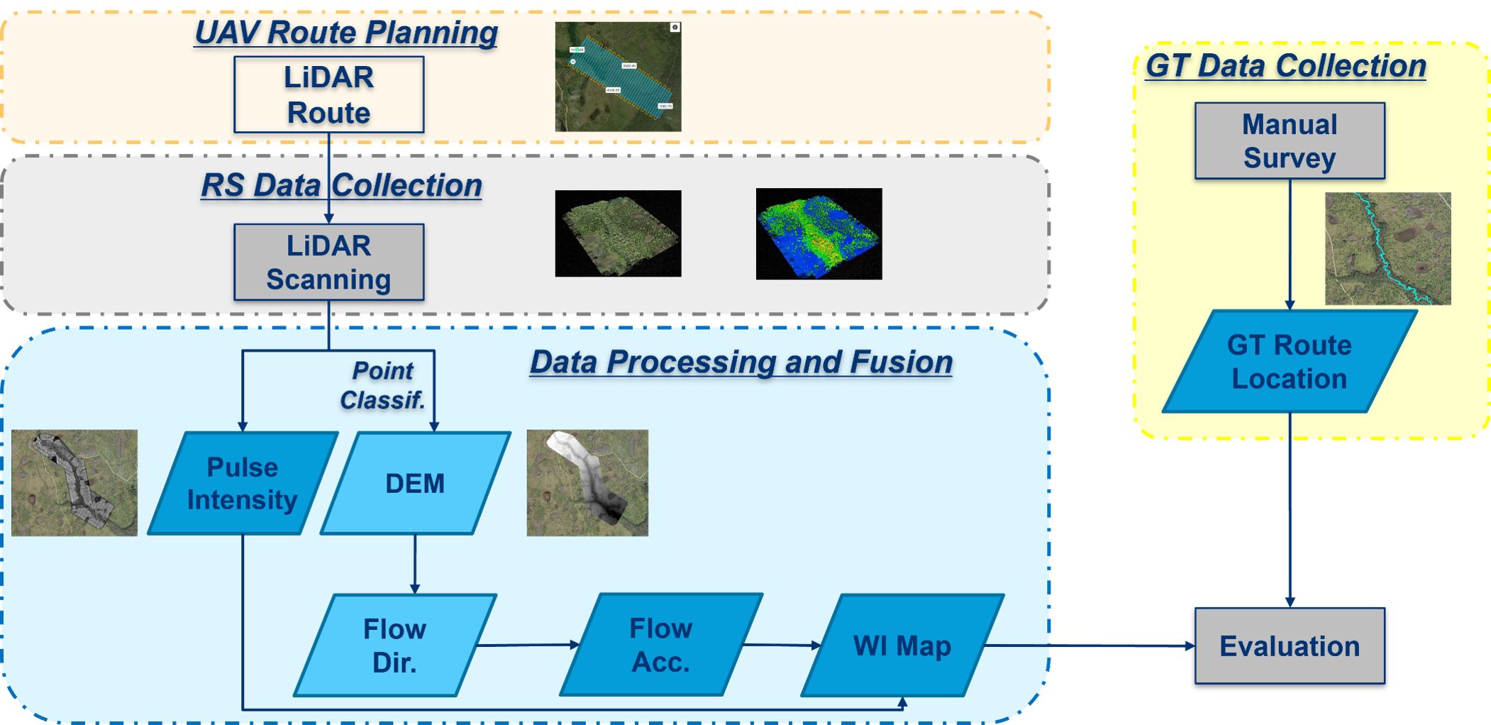
Accurate mapping of water bodies and analyzing watershed dynamics are crucial for understanding hydrologic processes like baseflow recession and surface water-groundwater interactions. Traditional methods, such as satellite imagery, often lack the spatial resolution to capture small waterways in densely vegetated areas, driving the adoption of UAV-based lidar technology. UAV-based lidar offers high precision by collecting detailed 3D data in diverse terrains, including areas with dense tree canopies. It penetrates vegetation, isolates ground data, and provides accurate representations of water surfaces and topography, outperforming traditional methods in challenging environments like Florida’s forests. This research applies UAV-based lidar to estimate water surface areas with high accuracy, focusing on small creeks obscured by dense vegetation. By filtering non-relevant data and using lidar ground returns, it generates robust models of water bodies that support dynamic hydrologic modeling and seasonal watershed monitoring. (Conference Presentation, Workshop Presentation)